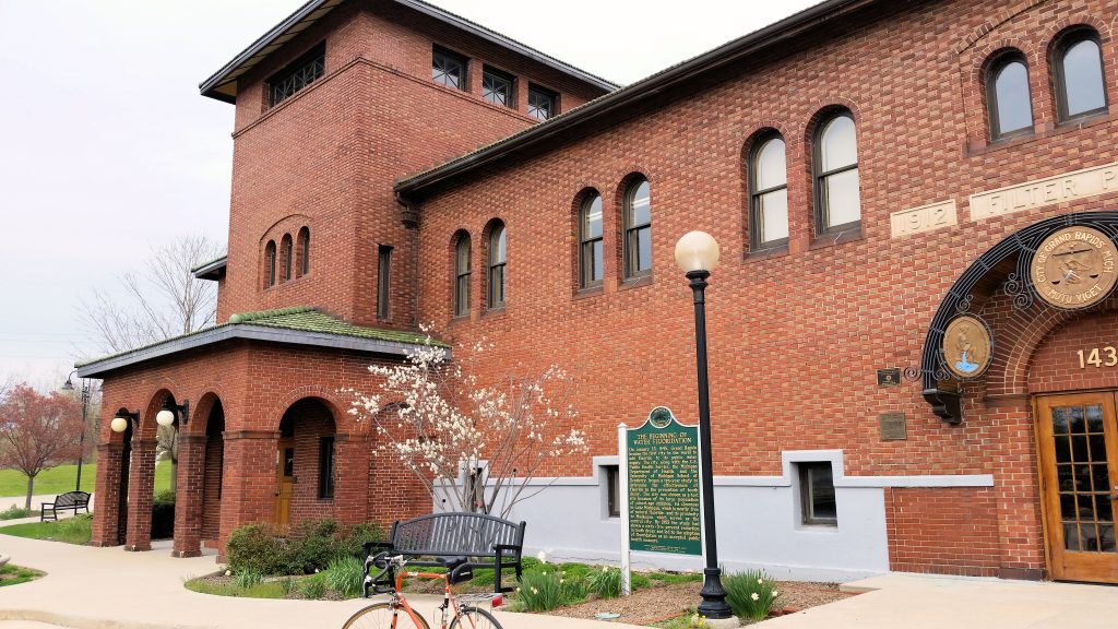
Grand Rapids’ Water Treatment Plant; Grand Rapids, Michigan (+42.9893, -85.6704)
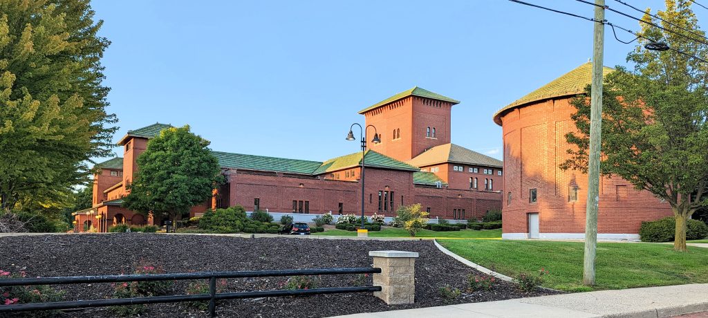
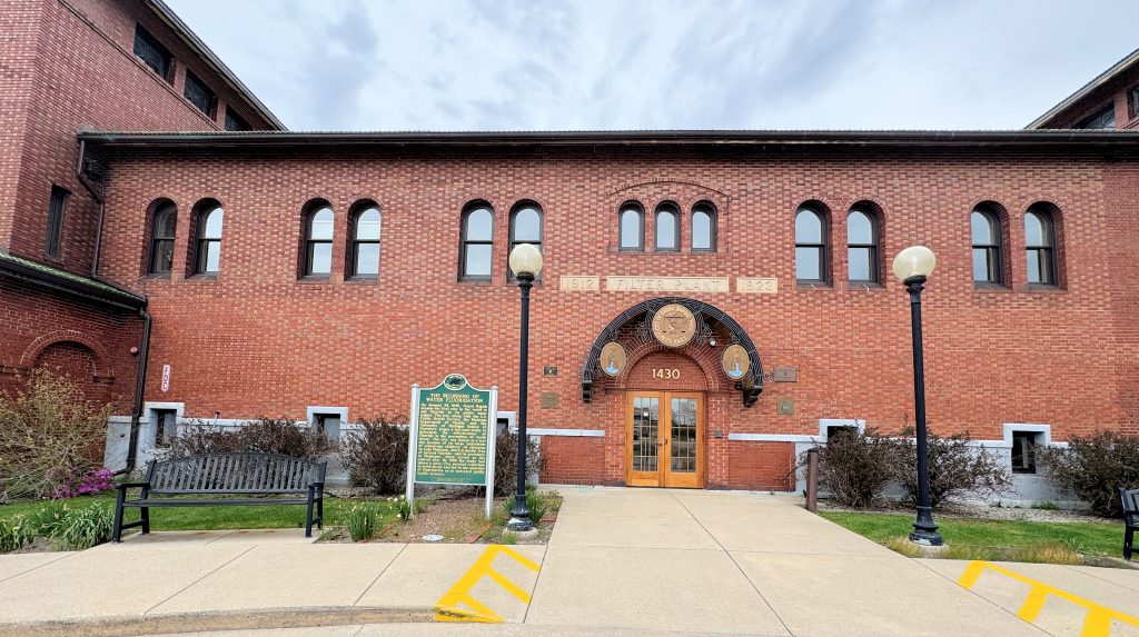
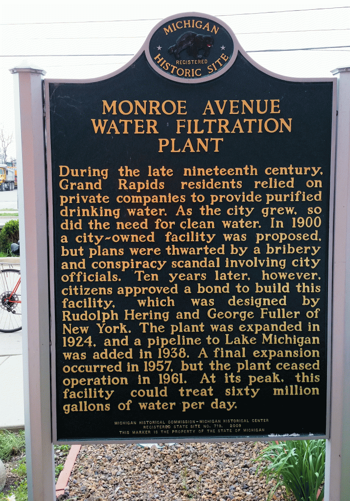
On the north side of Grand Rapids, not far from the Grand River is a beautiful red brick complex. It was built in 1912 for providing drinking water to the city. The water was pulled from the Grand River and treated for the public. This seems a little frightening today, when we realize how many impurities were in the river, but it provided a needed service. More information is listed on the historic marker at the site. The building today is a complex of offices, and Grand Rapids water comes from Lake Michigan.
The most unique historical fact about the plant was that it was the first place where fluoride was added to public drinking water to reduce tooth decay. Too much fluoride can discolor teeth and cause other problems, but the minute amount added to water in 1945 was a game changer in 1945. For more information, see the article by the National Institute of Dental and Craniofacial Research (part of the National Institute of Health). In case the government decides that this part of our history should be removed, here are the parts pertaining to NIH and Grand Rapids:
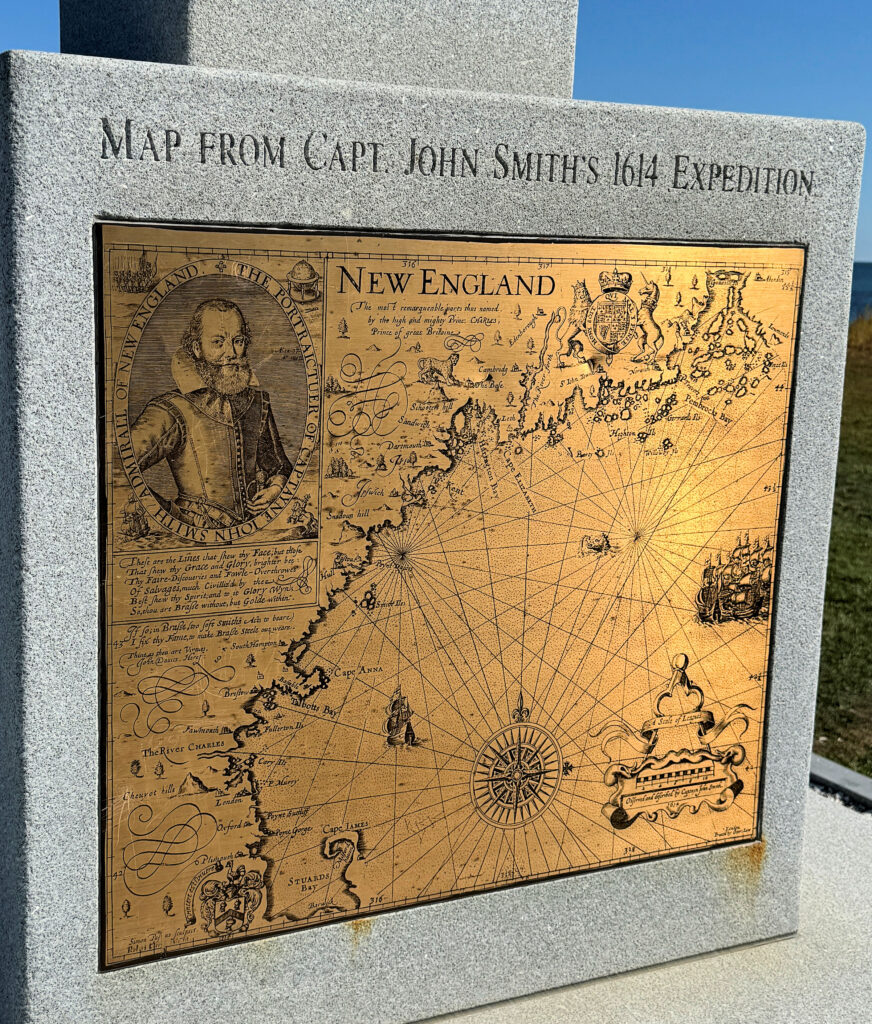
The architect of these first fluoride studies was Dr. H. Trendley Dean, head of the Dental Hygiene Unit at the National Institute of Health (NIH). Dean began investigating the epidemiology of fluorosis in 1931. … By the late 1930s, he and his staff had made a critical discovery. Namely, fluoride levels of up to 1.0 ppm in drinking water did not cause enamel fluorosis in most people and only mild enamel fluorosis in a small percentage of people. … This finding sent Dean’s thoughts spiraling in a new direction. He recalled from reading McKay’s and Black’s studies on fluorosis that mottled tooth enamel is unusually resistant to decay. Dean wondered whether adding fluoride to drinking water at physically and cosmetically safe levels would help fight tooth decay. This hypothesis, Dean told his colleagues, would need to be tested. In 1944, Dean got his wish. That year, the City Commission of Grand Rapids, Michigan- after numerous discussions with researchers from the PHS, the Michigan Department of Health, and other public health organizations-voted to add fluoride to its public water supply the following year. In 1945, Grand Rapids became the first city in the world to fluoridate its drinking water. The Grand Rapids water fluoridation study was originally sponsored by the U.S. Surgeon General, but was taken over by the NIDR shortly after the Institute’s inception in 1948. During the 15-year project, researchers monitored the rate of tooth decay among Grand Rapids’ almost 30,000 schoolchildren. After just 11 years, Dean- who was now director of the NIDR- announced an amazing finding. The caries rate among Grand Rapids children born after fluoride was added to the water supply dropped more than 60 percent. This finding, considering the thousands of participants in the study, amounted to a giant scientific breakthrough that promised to revolutionize dental care, making tooth decay for the first time in history a preventable disease for most people.
It is frustrating that fears of fluoridation could reverse this trend. HHS Secretary Kennedy has stoked these fears. In May of 2025, Utah began banning the use of fluoride in its public water. Florida also has a new law that restricts local governments from adding fluoride to drinking water. It is hoped that people will use other tools, such as treatments by their dentist, to help prevent tooth decay, but the cost of doing something extra for dental treatment could make it more likely that the poor will not do it, and suffer the consequences.
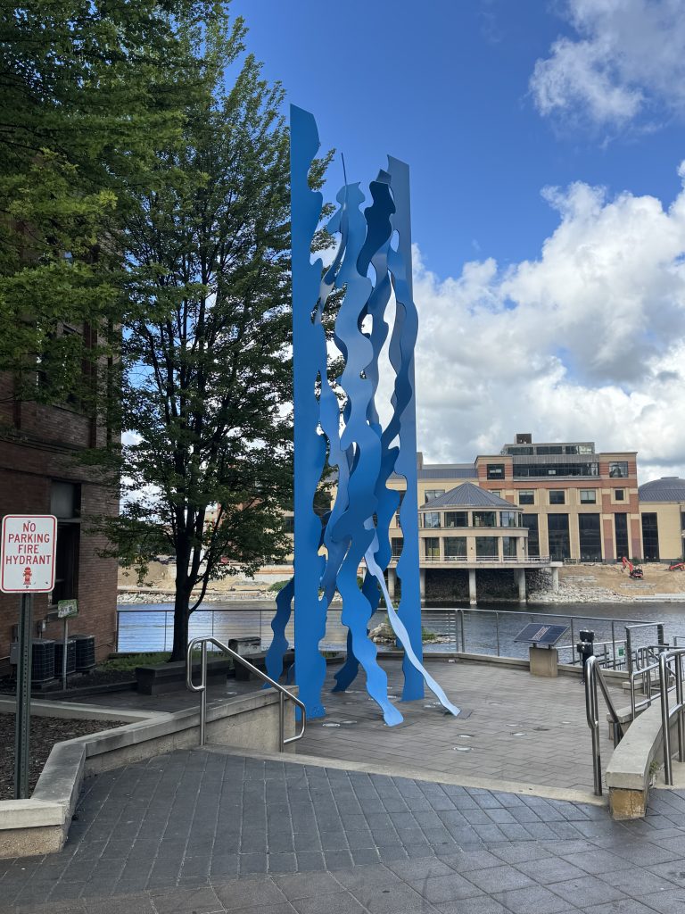
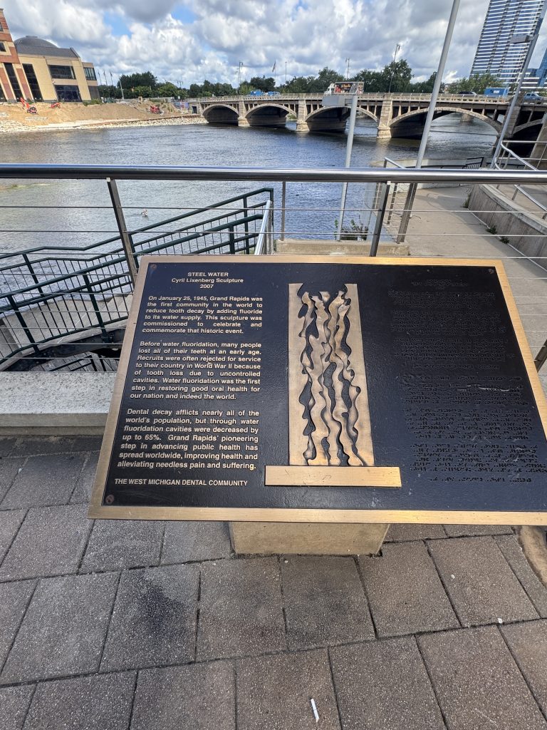
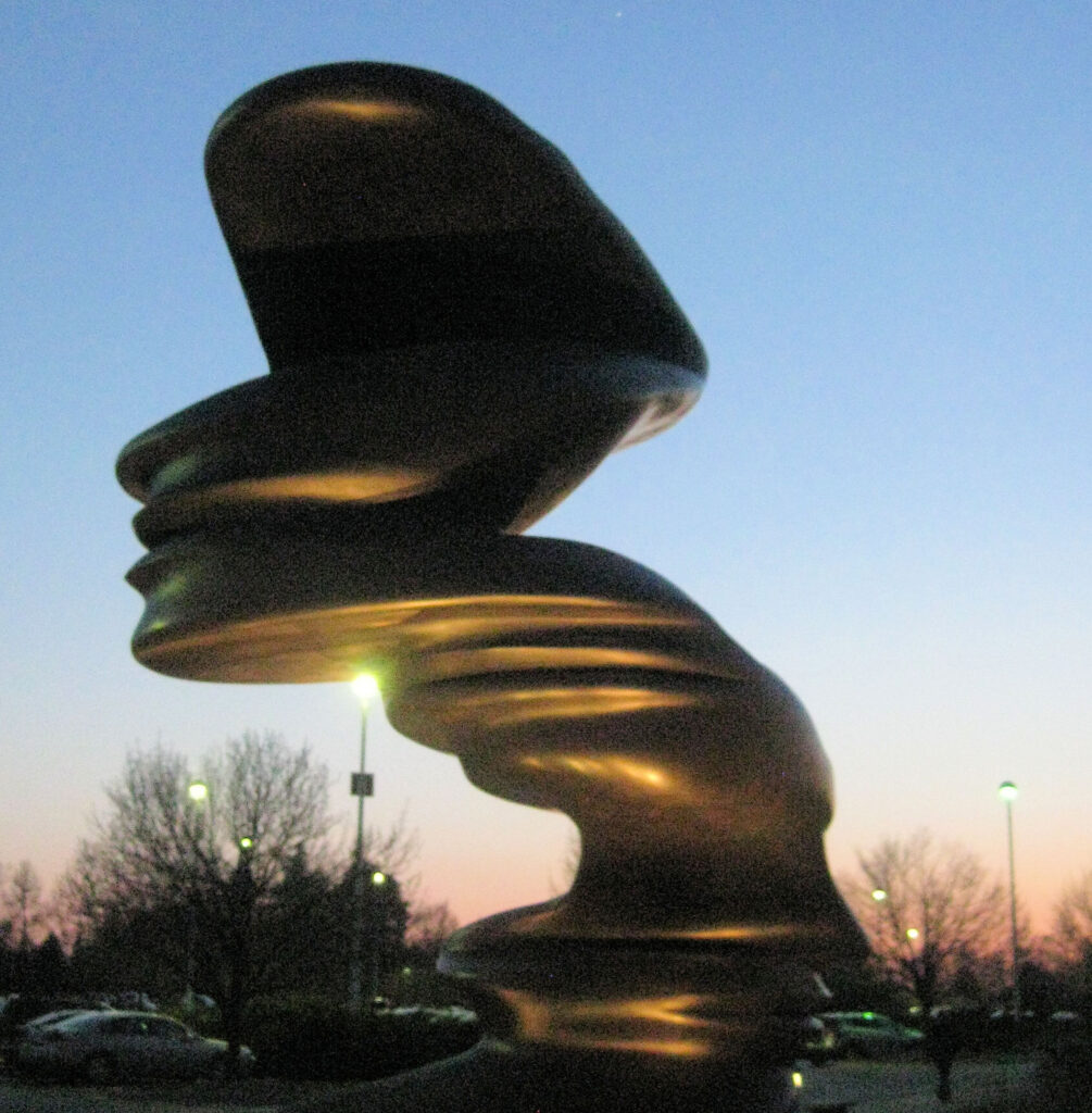
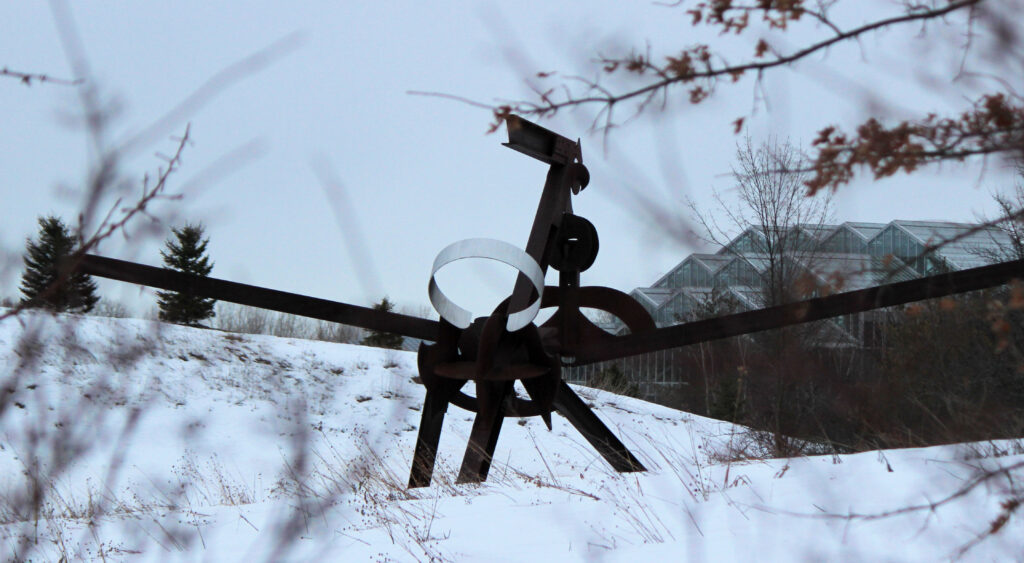
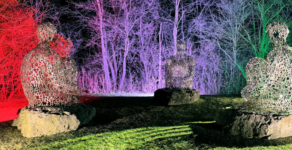
Steel Water sculpture (+42.9655, -85.6744)
Just over 1.6 miles south of the water filtration plant, across the river from the Public Museum, is a sculpture by the West Michigan Dental Community to mark the work done in 1945. It was created by Cyril Lixenberg (1932-2015), a Dutch sculptor, in 2007.
For more information:
https://www.nidcr.nih.gov/health-info/fluoride/the-story-of-fluoridation
https://www.bbc.com/news/articles/c4gmggp2y99o
https://en.wikipedia.org/wiki/Water_fluoridation
https://www.historygrandrapids.org/photo/751/cyril-lixenberg-creator-of-ste
Book: The Fluoride Wars: How a Modest Public Health Measure Became America’s Longest-Running Political Melodrama (2009), by R. Allan Freeze, Jay H. Lehr